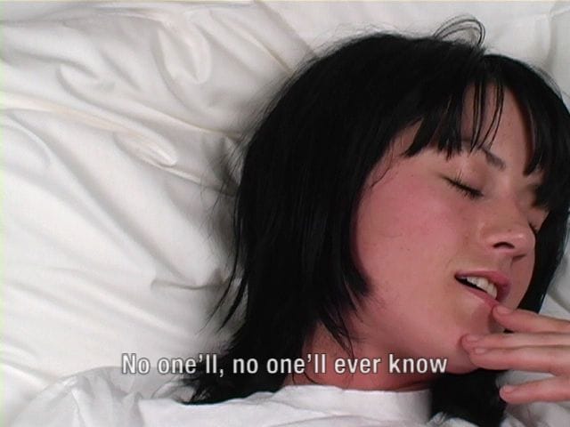
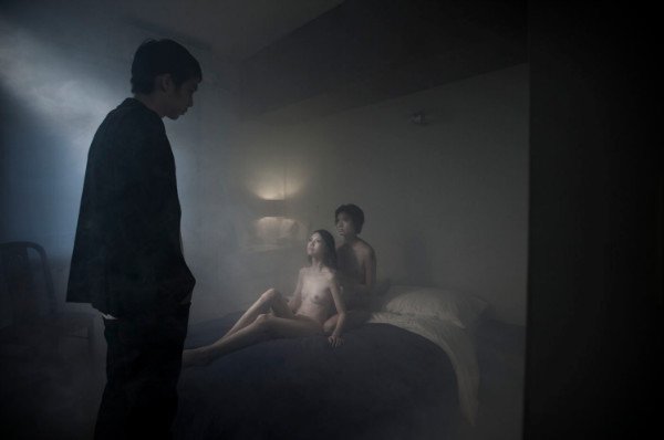
_____________ Jeremy ShawDMT, 2003 ‘Jeremy Shaw’s new video installation, DMT, is an intense octagonal space that highlights the disjunctions of social communication. While watching the subjects high on the hallucinogenic drug, DMT, and reading their attempts to describe the out-of-body experience, we become both seduced and repelled by these hyper-real portraits.’
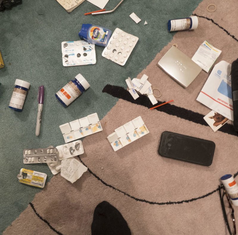
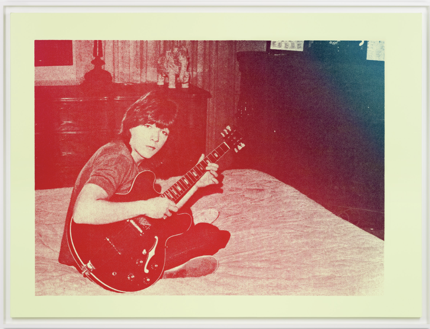
_______________ Nan GoldinDrugs on the Rug. New York City, USA, 2016 Digital print on Fuji Crystal Archive Matte paper
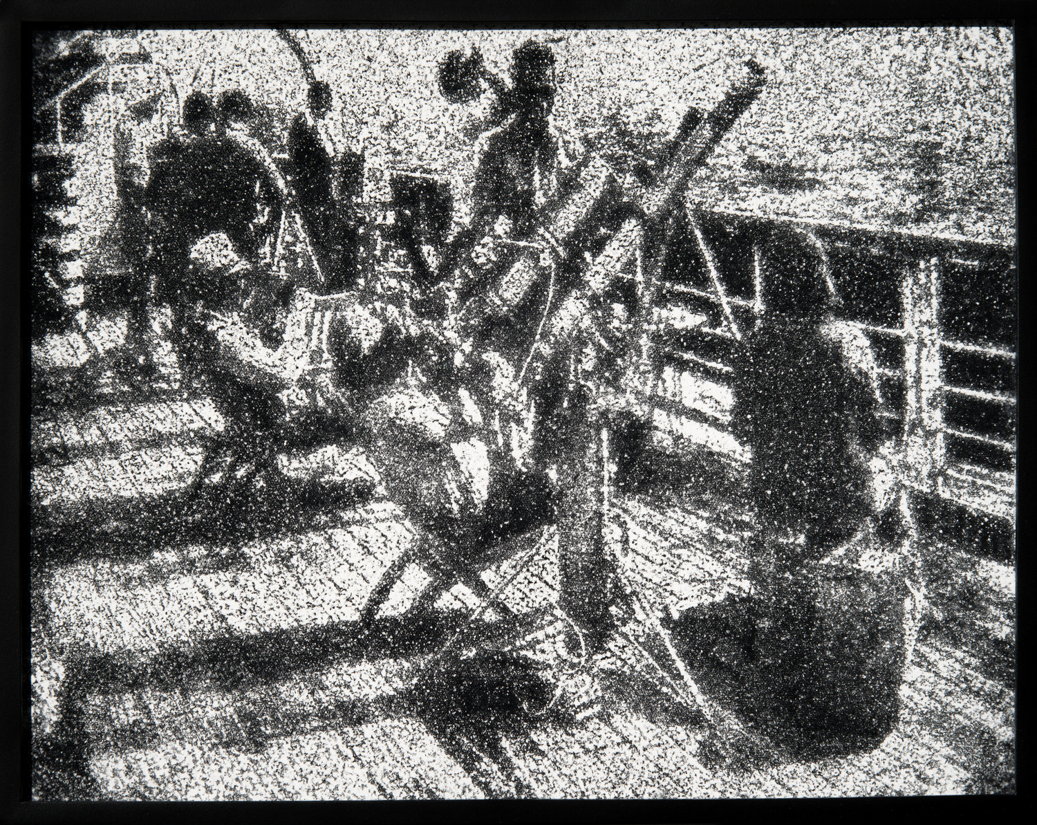
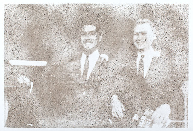
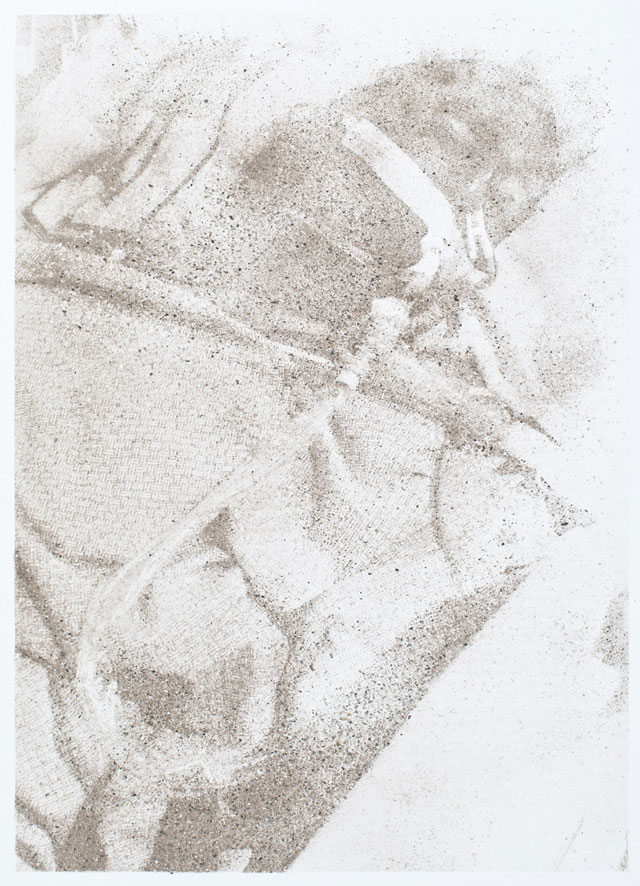
_______________ Matthew BrandtAstronomers on Boat, 2013 cocaine dust on photographer’s velvet
_______________ Etienne O’LearyHomeo, 1967 ‘Despite an entire filmography of only three experimental short films, Étienne O’Leary’s work is a vibrant, majestic reflection of late 60s drug culture and avant-garde film techniques, including some pioneering editing tricks that still seem fresh and invigorating today. A 60s French dandy by way of Montreal, O’Leary became intoxicated by the sights and sounds of bohemia and formed an alliance with the Zanzibar Group (his films are populated by French underground luminaries like Pierre Clementi, Jean-Pierre Bouyxou, and Michel Auder). A student of the New York underground and surrealism, O’Leary uses a variety of notebook-style shooting, image layering, and fast cutting to capture the era’s heady decadence and political possibilities. Adding to the trippy visuals, O’Leary composed his own singular soundtracks with a myriad of found instruments and tape recorders, a new music genre in and of themselves.’
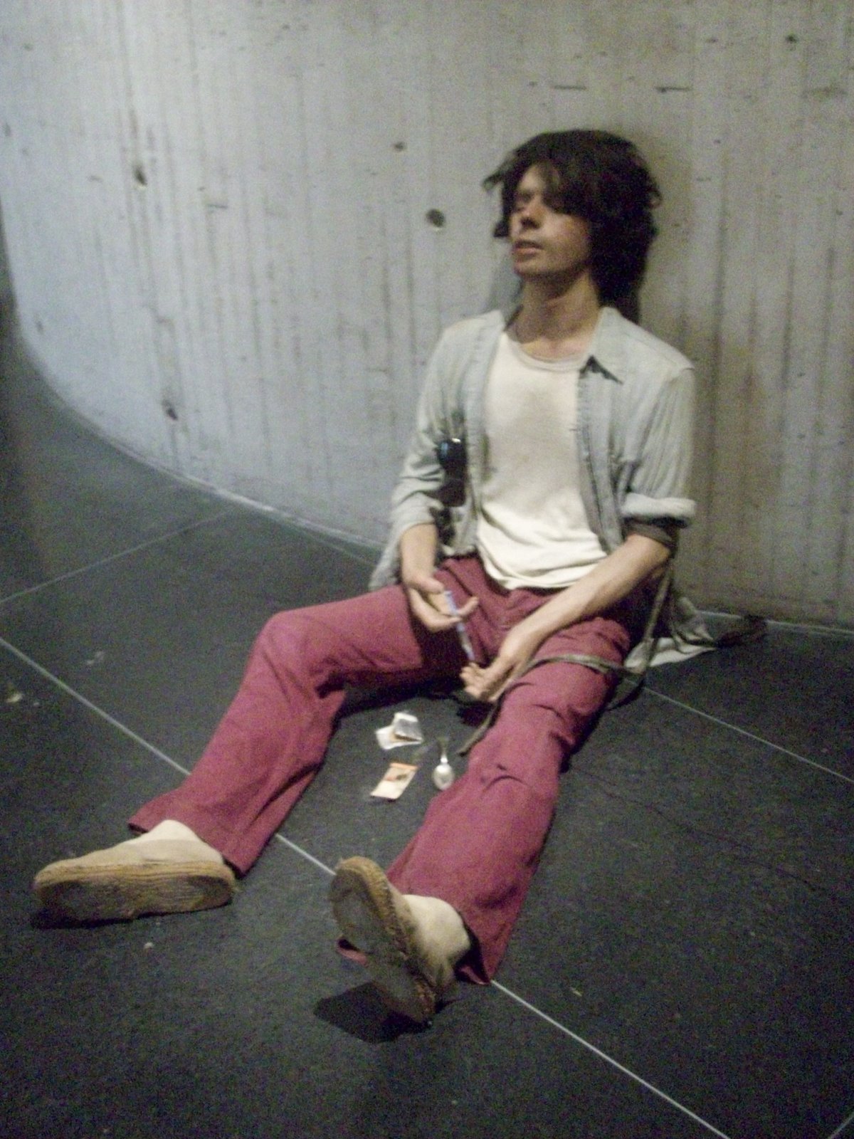
_______________ Duane HansonDrug Addict, 1974 ‘Hanson’s super lifelike sculpture portrays a male person sitting down and leaning against a wall. His right hand is holding a syringe and just above the left elbow his left arm is tied with a belt. His eyes are shut as he leans against the wall suggesting that he just injected himself with drugs.’
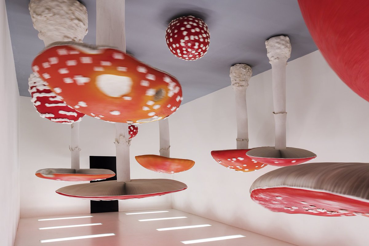
_______________ Carsten HöllerUpside Down Mushroom Room, 2000 room with giant, rotating, upside down, imitation fly agaric mushrooms lit from underneath
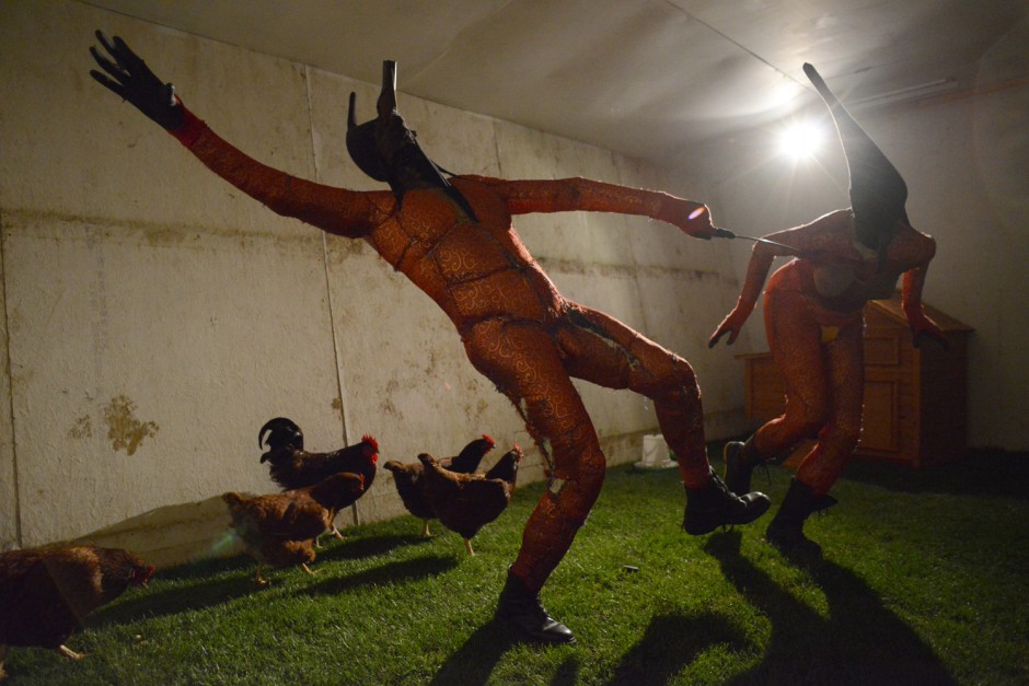
_______________ Tim ShawKetamine, 2011 ‘Ketamine recounts a festival scene in which two individuals dressed as elves dance wildly whilst on the powerful mind altering chemical.’
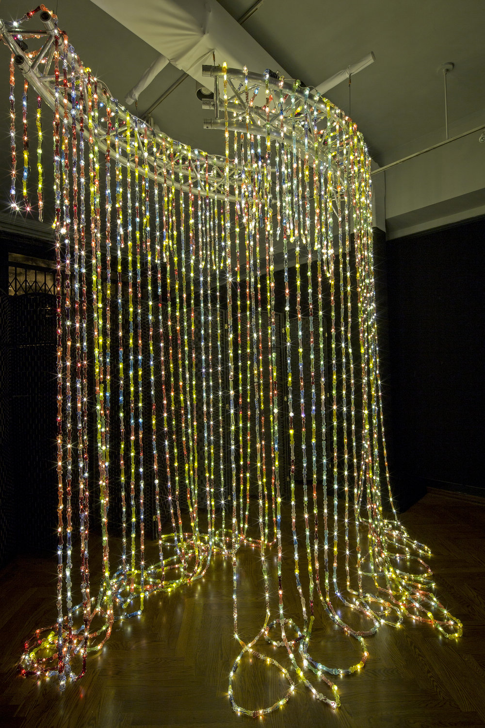
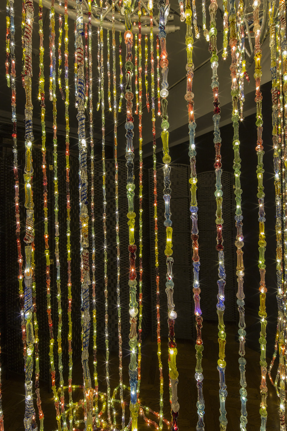
_______________ Bentley MeekerBongolier, 2015 ‘A chandelier made out hand-blown glass marijuana pipes entitled the “Bongolier.”‘
_______________ Nikita ShalennyiWhere is your brother?, 2013 photograph
_______________ Joey RobinsonMe me me me me, 2016 camera, ketamine, aftereffects
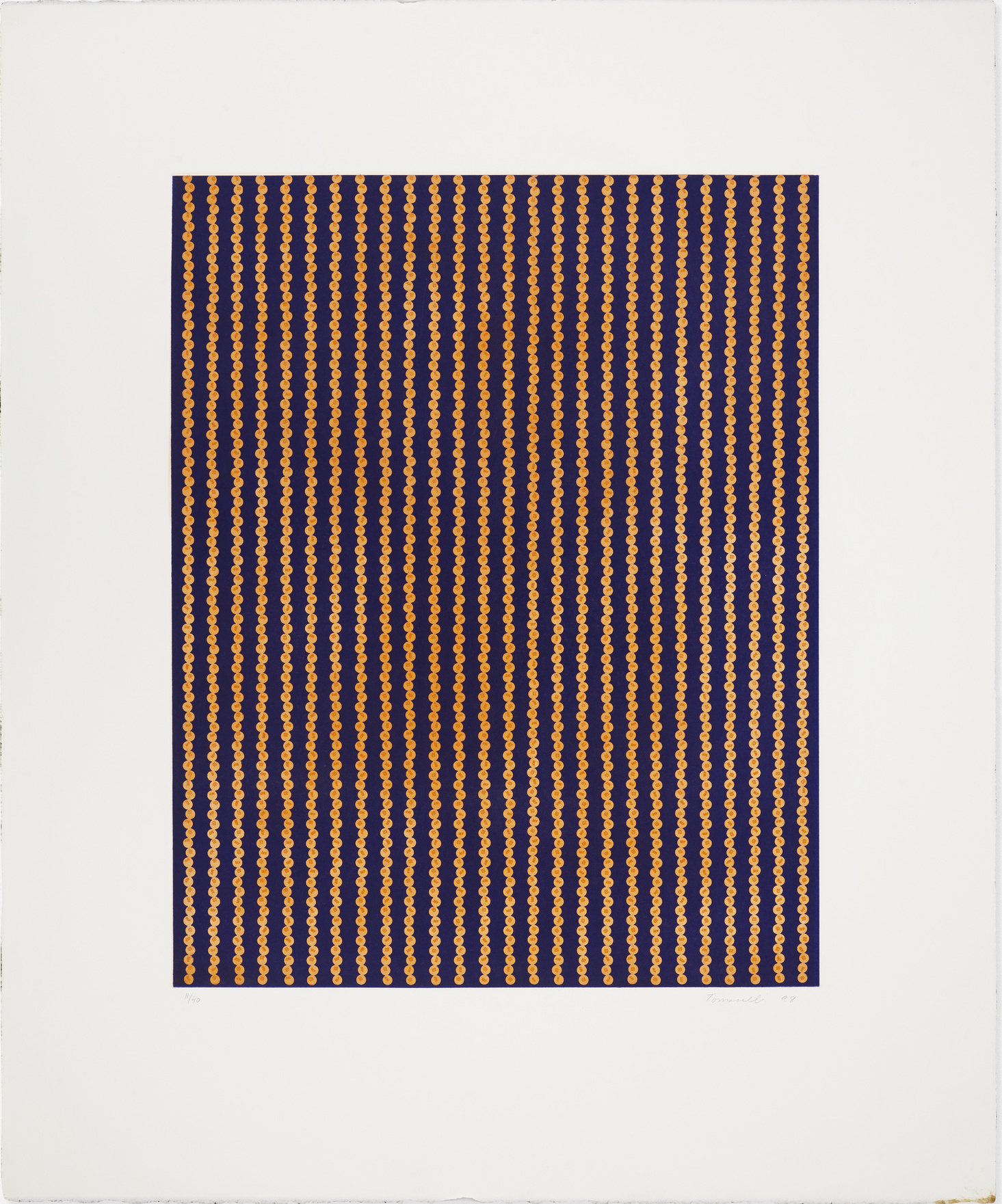
_______________ Fred Tomaselli15 mg. of Meth Times 2000 Plus, 1998 aquatint photo etching
_______________ Su Hui-YuStilnox Stroller, 2011 ‘In 2011, Su Hui-Yu, a Taiwanese artist based in Taipei, held an exhibition called Stilnox Stroller. The performance consisted on a party-like setting with music and people acting as if they were really at a party. During the performance, the artist would give the audience some pills (allegedly Stilnox) and talk about the principles of the drug. Then he would encourage them to talk about the side-effects of the pill. All this with the finality of showing the full experience of consuming this drug without a medical purpose. The name of the exhibition, which is a reference to sleepwalking, shows what it’s like to be “awake” and under the effects of a drug that is supposed to numb your brain and force you into sleep mode. This sleep deprivation causes feelings of numbness, which may lead to hallucinations. So, at the end of the day, the exhibition’s aim was to make people experience what it feels like to be in a group of sleepwalkers attending an art opening. So, here’s the video projected at the performance. While it is hard to untangle its meaning, in my opinion it portrays hallucinations and the use of prescribed drugs.’
_______________ Richard PrinceKatz + Dogg, 2019 ‘Artist Richard Prince has launched a new cannabis line called Katz + Dogg, produced in collaboration with 710 Labs. Prince is the first artist to have his own line of marijuana. The line includes flowers, pre-rolled joints, and vape pens, and will be available at high-end dispensaries around the US. 710 Labs’ Shire, Ice Cream Cake, and OG strains are available. Prince’s famous Hippie Drawings and High Times paintings feature on the packaging.’
_______________ Tom SachsBong Hit Station, 2013 ‘Tom Sachs’s 2013 video Bong Hit Station provides potential newbies a detailed (and unnecessarily complex) guide to getting stoned.’
_______________ BeejoirA Pill a Day, 2011 Plaster, paint
______________ Zefrey ThrowellVarious, 2013 ‘Throwell’s father was a lifelong drug addict who died of a meth overdose seven years ago. As part of the original incarnation of his project, Throwell used his father’s ashes and meth, the drug that killed him, to make eight portraits of his dad that spanned the entirety of his life. Sadly, the original portraits were destroyed during last fall’s Hurricane Sandy, along with almost all the art Throwell made in the previous two years. For his current show, Throwell’s mother offered her son her share of his father’s ashes which he combined with a new supply of meth.’
“Douglas Throwell #9, 7 Years Old”
“Douglas Throwell #10, 20 Years Old”
“Douglas Throwell #12, 32 Years Old”
“Douglas Throwell #13, 44 Years Old”
“Douglas Throwell #16, 59 Years Old”
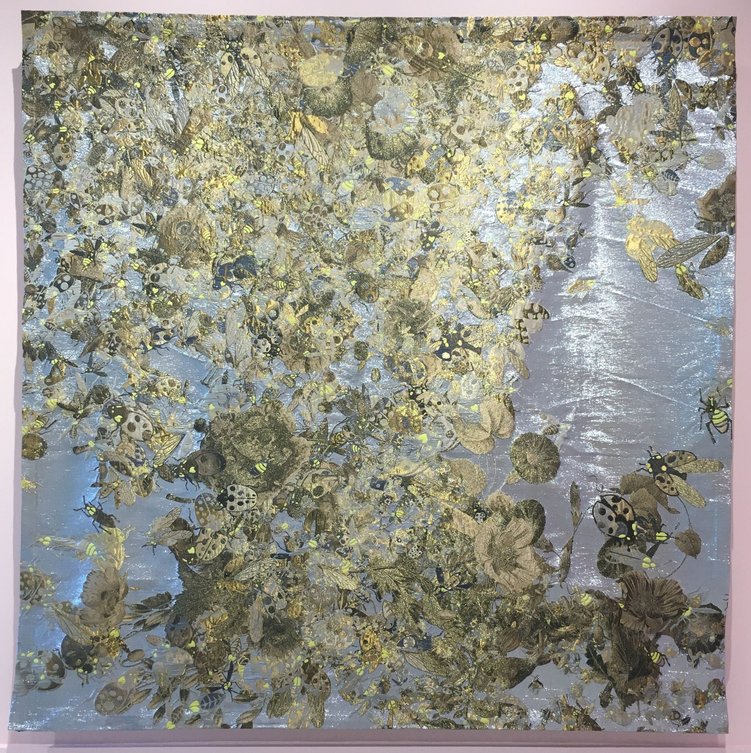
______________ Steven ShearerDavid’s Hollow Body, 2020 Ink and acrylic on poly canvas
______________ Simon BlackmoreLSD Drive, 2006 ‘Blackmore’s custom-built LSD Drive is able to interpret lost data on apparently useless CDs, and process it using a program written in the Open Source software, SuperCollider. Light Sensitive Disk Drive is a fully functioning prototype hardware/software product that explores ideas of technological progress, technological waste and its environmental impact. CDs in various states of degradation can be played on the drive to produce different sounds from the lost areas of data.’
______________ Julie FavreauAnomalies, 2012 ‘For her 2012 installation, Anomalies, Julie Favreau took as inspiration a Soviet-era novella about science gone awry, but then utterly transformed it into a series of hallucinogenic scenarios with enigmatic objects, to “suggest parables about the judicious use of knowledge and technology, and about personal discipline and mindfulness”.’
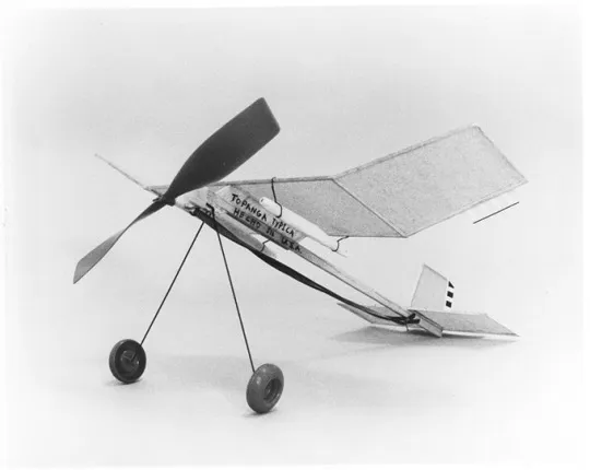
______________ Chris BurdenCoals to Newcastle, 1978 ‘Calexico, California and Mexicali, Mexico are actually the same city separated by a tall steel and barbed wire fence demarcating the international border between the U.S.A. and Mexico. On the morning of December 17, standing on the American side of the border, I flew a small rubber band powered model airplane over the fence into Mexicali, Mexico. From each wing of the plane, like a miniature bomb, hung a cigarette of the finest seedless marijuana, ‘sinsemilla’ grown in California.The plane bore the following inscriptions: Hecho en U.S.A. (‘Made in U.S.A.’), Fumenlos Muchachos (‘Smoke it, kids’) and Topanga Typica (‘typical Topanga’).’
________________ Haroon Mirzaããã, 2016 ‘Developed during a two-month residency in São Paulo, captured images and sounds from the city combine as four videos and eight channels of electric signal visualised through strips of LED light and heard via an array of speakers all in synchronization. The videos reflect on a heady mix of entheogens (plants that have psychedelic properties like the ones used in Ayahuasca) and developments in physics and cosmology, while the overall experience of the work collectively creates a mesmerizing visual and aural effect.’
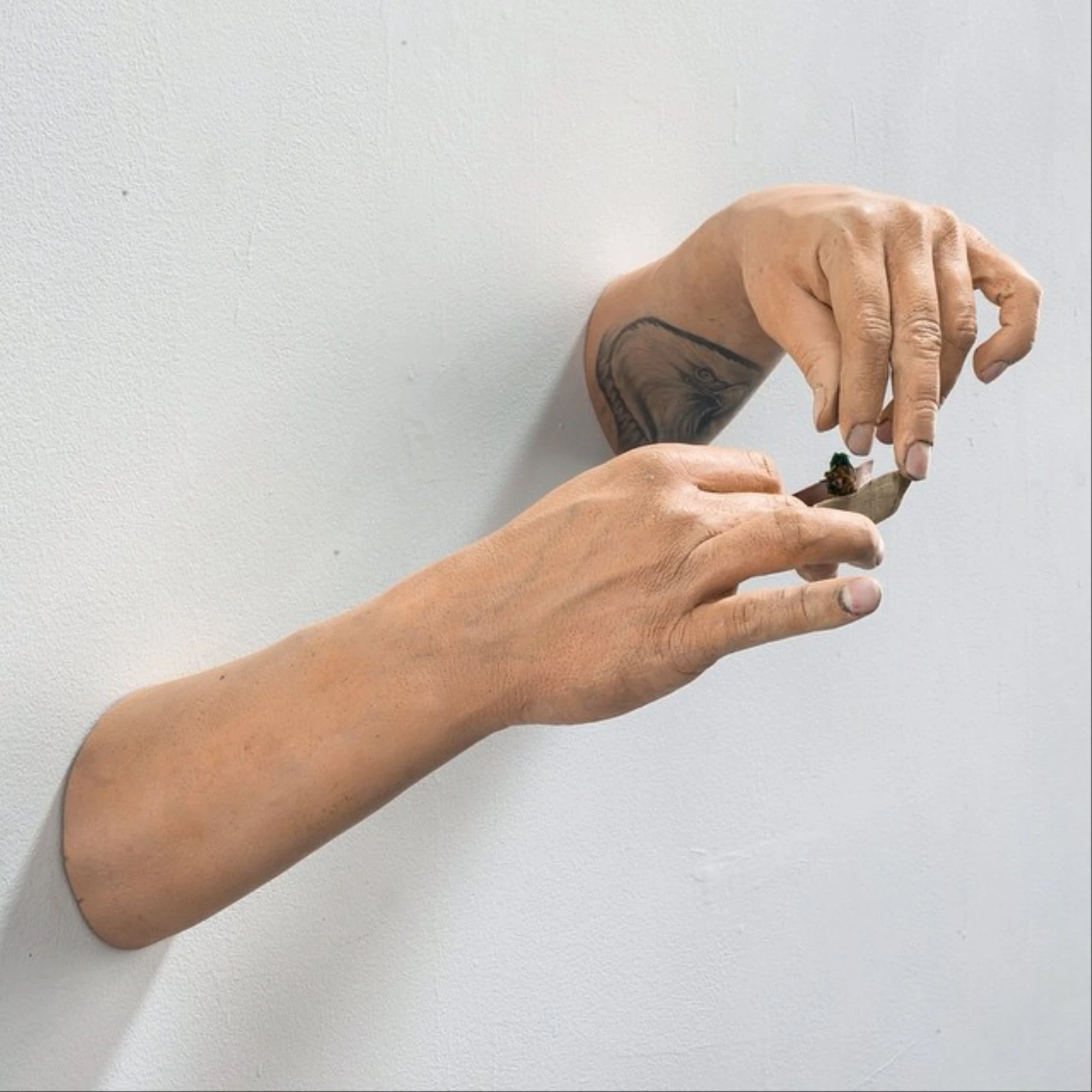
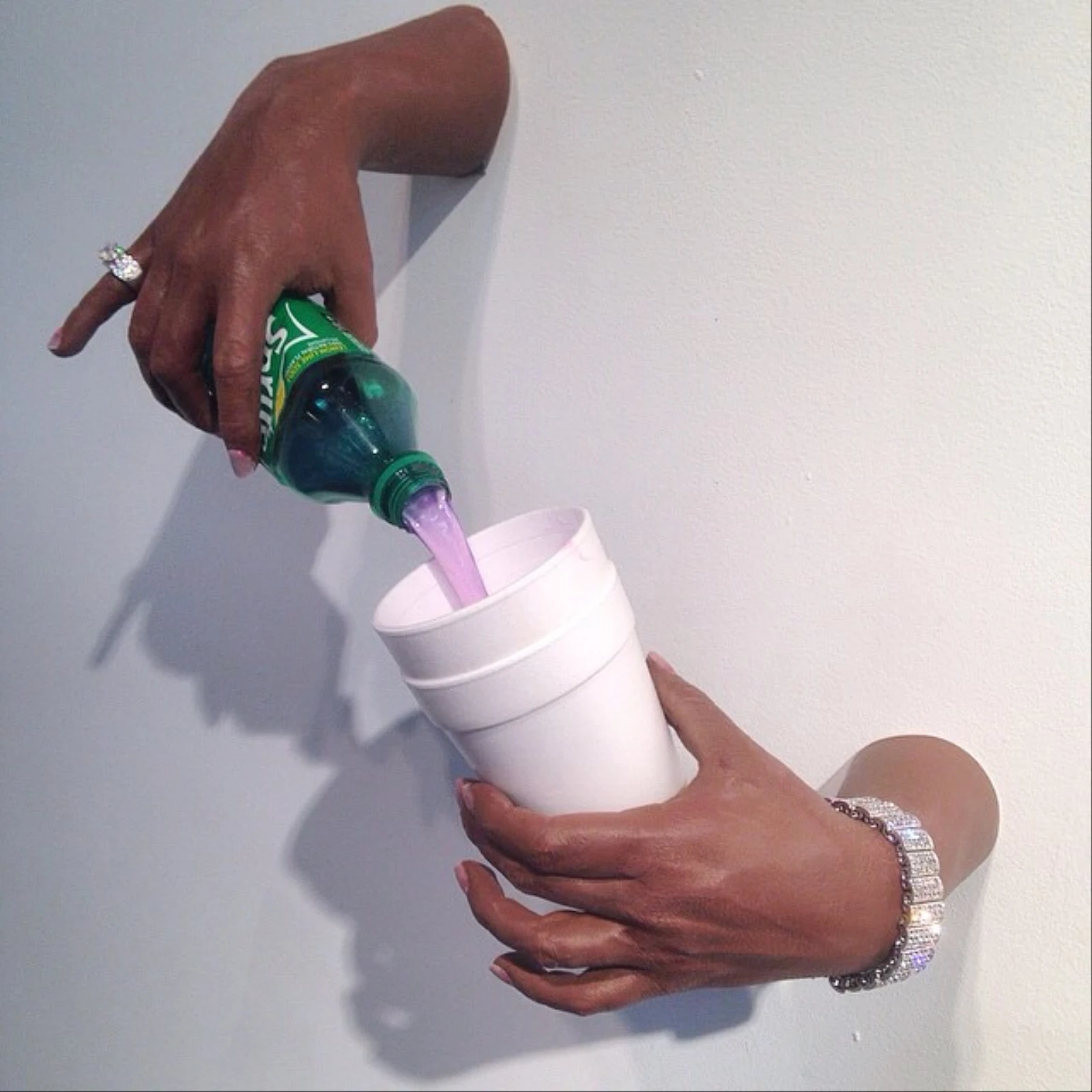
________________ Sergio GarciaVarious, 2014 – 2017 ‘Garcia has created a large body of work examining the way weed is perceived in pop culture. At international street art festival POW! WOW! Hawaii, Garcia created a series of wall-mounted ashtrays replete with burning joints adhered to their insides. His latest is a model of Action Bronson’s tattooed forearms dabbing. Bronson’s arms join Garcia’s repertoire of celebrity replicas that also includes Future counting cash and pouring lean out of a Sprite bottle. Garcia is a self-taught artist who came into the contemporary art world from the street art scene and painting motorcycles. He mostly smokes socially, but admits, “it helps a lot with my creative process.” He went from smoking every day in high school to indulging in an edible at the occasional concert in a curve that seems to correlate with his success in the contemporary art scene. That growth is reflected in his plans for 4/20 this year. “I’m not sure yet,” he tells Creators. “I was planning on going to LA. But I may have to just stay in the studio.”‘
_______________ Ann Veronica Janssens Donut, 2003 ‘The viewer is assaulted with a succession of vividly colored, concentric circles that flash up on a large screen and trigger weirdly long-lived retinal afterimages.’
_______________ Karpo GodinaThe Gratinated Brains of Pupilia Ferkeverk, 1970 ‘The Gratinated Brains of Pupilia Ferkeverk features the Slovenian poets who constituted a collective called Pupilia Ferkeverk. The movie opens with a shot of a woman on a swing, shot at different times of day and night, and in different weather. When we think, after a minute or two, that we are going to see nothing else, other characters suddenly interject themselves, standing naked or nearly naked in the water, miming different stages of life and politics, using symbolism so abstract as to be meaningless were it not for the captions that are in Slovene and are not translated into English. The characters all conclude that the universal solution is to take LSD.’
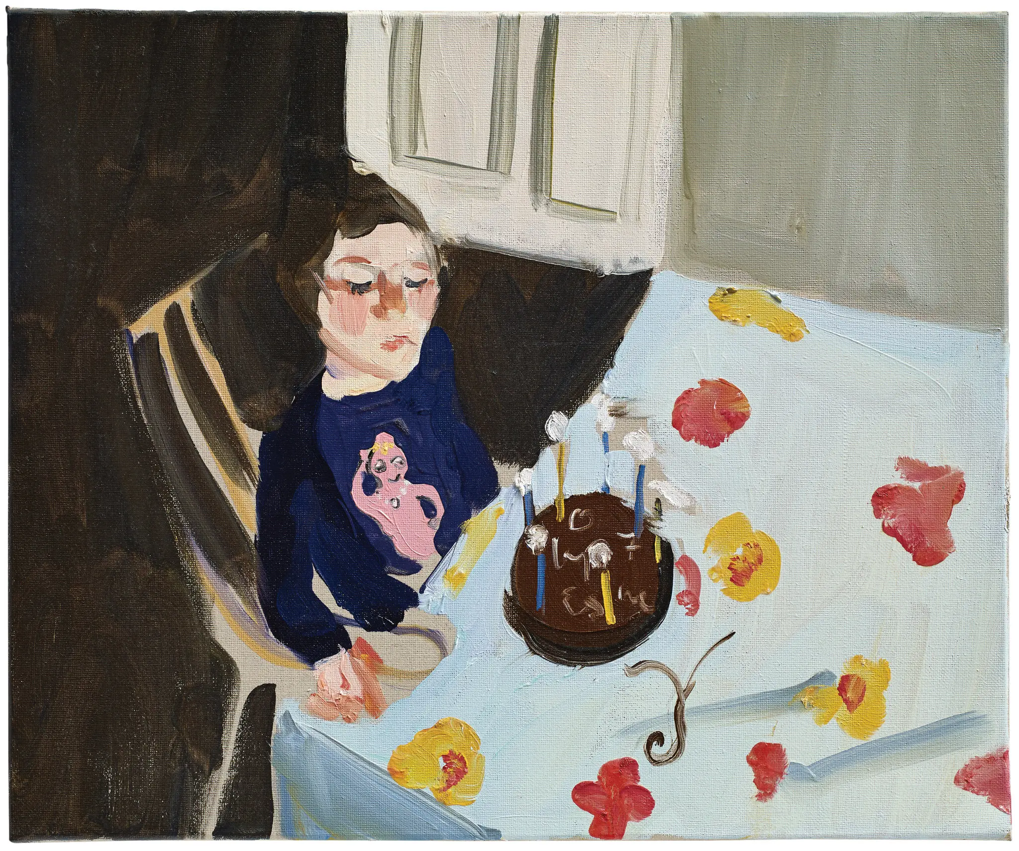
_________________ Chantal JoffeMy 11 year old son high on heroin at his birthday party, 2017 Painting
_________________ Ghislaine LeungShrooms, 2016 ‘Every visible unused socket within an exhibition to be filled with a mushroom nightlight and plug adapter.’
_______________ !Mediengruppe BitnikRandom Darknet Shopper, 2015 ‘The “automated online shopping bot” was set up in October last year by Swiss art group, !Mediengruppe Bitnik, as an art installation to explore the “dark web”—the hidden, un-indexed part of the Internet. Each week, the robot was given $100 worth of Bitcoin— the major hard-to-trace cryptocurrency—and programmed to randomly purchase one item from Agora, an online marketplace on the dark web where shoppers can buy drugs and other illegal items. The items were automatically delivered to a Swiss art gallery called Kunst Halle St Gallen to form an exhibition.
‘The robot was christened “Random Darknet Shopper” and its purchases included a Hungarian passport, Ecstasy pills, fake Diesel jeans, a Sprite can with a hole cut out in order to stash cash, Nike trainers, a baseball cap with a hidden camera, cigarettes and the “Lord of the Rings” e-book collection.
‘Perhaps unsurprisingly, the robot and his artistic creators had a run in with the law. In January 2015, the Swiss police confiscated the robot and its illegal purchases. However, three months later, the Random Darknet Shopper was returned to the artists, along with all its purchases except the Ecstasy (also known as MDMA) tablets, which were destroyed by the Swiss authorities.’
_________________ Elke Andreas BoonTrain, 2000 ‘Point of view of a train passenger. Looking through the window of the train you can see the landscape. A teenaged boy dressed as a girl jumps away from the rails, runs towards the train and rants and raves with large gestures. You can’t hear him. As the train moves on the scolding boy-girl disappears out of sight.’
________________ Hugo BadgerNose Roomba, 2009 sculpture, motor, white powder
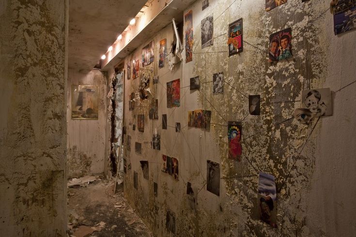
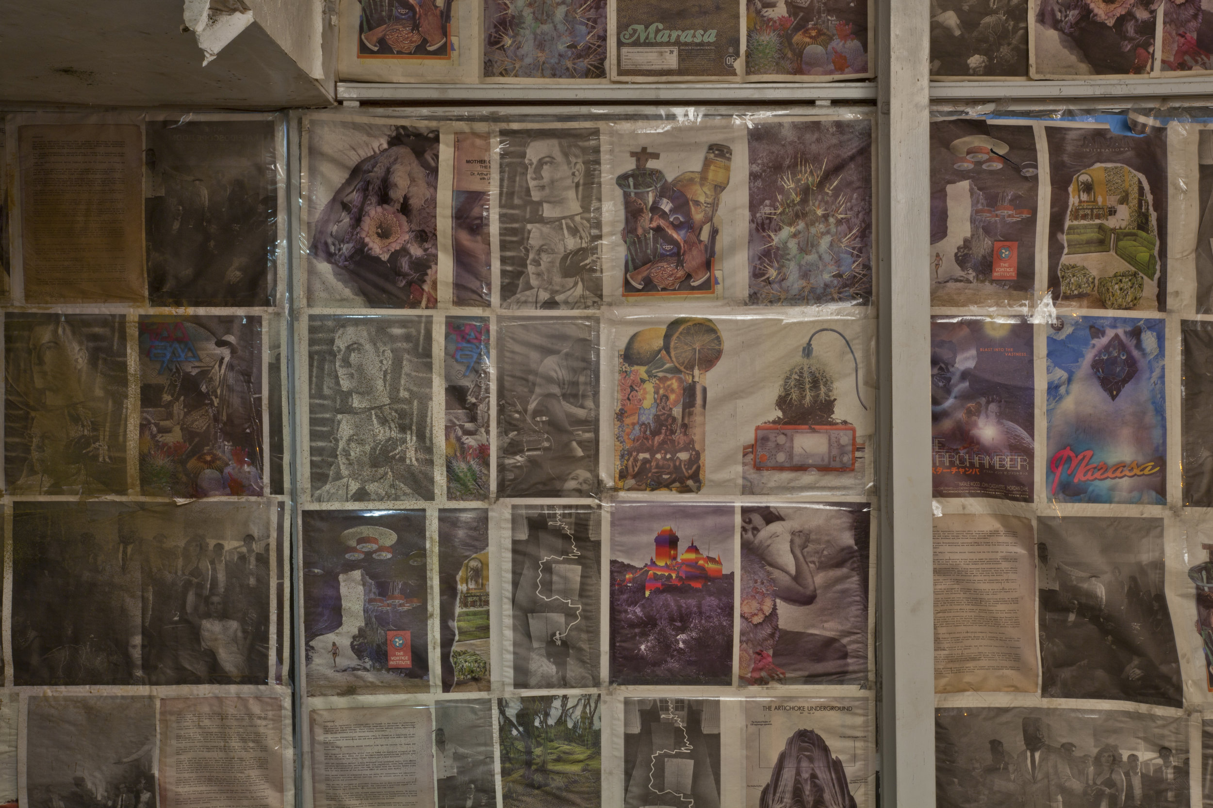
________________ Jonah Freeman and Justin LoweBright White Underground, 2010 ‘For “Bright White Underground,” Freeman and Lowe imagined the Buck House, Rudolf Schindler’s architectural landmark which is situated a few blocks from the Los Angeles County Museum of Art, as a sort of LSD safe house of the variety that the C.I.A. maintained when covertly testing the hallucinogenic substance in the 1950s. In Freeman and Lowe’s constructed narrative, Marasa, a drug modeled after LSD, was being developed by a certain Dr. Arthur Cook through the Vortice Institute, his psychoanalytic practice. Marasa, Haitian for the sacred twins of voodoo, alludes to the doubling effect of their novel hallucinogen: being high on the drug resulted in seeing your alter ego. Bright White Underground builds upon the artists’ dimensional narrative universe, which involves a wide variety of social and historical environments such as secret uptown societies, clandestine meth labs, and abandoned hippie communes, among others. The themes central to their work are specifically alchemy in a modern context and community, ritual and psychosis.’
*
p.s. Hey. ** David, We had a 10 minute storm the other night, but otherwise it’s still as Evian outside (but without the water). Glad you liked the Cornell. Hope your weekend is fortuitous. ** Maria, Isabella, Camila, Malaria, Gabriela, My pleasure! ** Verity Pawloski, Hi. ** _Black_Acrylic, Hi, Ben. Understood about the Play Therapy skip, of course. Thank you for the track, which I will listen to with fondness. I love that ‘Naked City’ record. ** David Ehrenstein, I will celebrate your b’day a little late by seeing what ‘Oh Diogenes!’ is all about. Everyone, Mr. Ehrenstein points us at the film ‘East of Borneo’ which was an inspiration for Joseph Cornell’s great film ‘Rose Hobart’ as seen here yesterday. Check it. ** Misanthrope, Always happy to be a fount. Autocorrect just changed ‘fount’ to ‘font’, which I’m happy to be too. Being a lifelong atheist, Hell and God and all those types of things are just fuzzy metaphors to me. Right, Presidents’ Day. I wonder if there’s anyone in the USA who actually thinks about them on that day? I guess no. My weekend has potential. Yours? ** Dominik, Hi, pal!!! Mm, I just read handful of books that’ll show up in a ‘book I loved’ post very soon. I’m just about to start reading John Waters’ novel. And the new issue of a lit. magazine called ‘Logue’ that someone sent to me. I’ve never read Augusten Burroughs, I don’t know why. I know of the book, and, yeah, the title does portend darkness, so … huh. I’ll try to check it out. Right, I forgot your mom is a ceramicist, and a very good one if I remember your share of her work correctly. Ha ha, please thank your love for his serenade, and especially thank him that it sounded like Eiffel 65’s ‘Blue’ and not Joni Mitchell’s ‘Blue’ since just hearing even a few seconds of her miserable songs and singing makes me want to tear my ears off. My love being chased through the streets by thousands of hysterical, fanatical, pitchfork wielding Joni Mitchell fans who read my blog today and blame my love for my Joni Mitchell besmirching until your love suddenly opens a street-level door and says ‘psst’ and then waves me inside to safety, G. ** Bill, Yes, thank you, Matthew Suss, wherever you may be. I might be remembering wrong, but I think Matthew Suss is the brother of Matmos’s Drew Daniel. Weekend away from the assigned work swamp, I hope, sir? ** JM, Hi, J! Mm, I definitely see the blog as a complicated and layered construction, but I don’t think about it in terms of my work or myself other than me being the obvious resource. Heck, I don’t even think about my fiction that way. I’m a pretty unselfconscious person, I guess. The blog is more a curatorial art project or something to me. My world? Waiting to be able to make the new film, starting to work on developing/ finishing the Haunt/videogame project, working on some fiction, trying to enjoy good old life. I know you’re headlong into some impending theater thing unless I misread your recent FB post. Oh, great, I’m so happy you like ‘Eat When You Feel Sad’! I love that book. I really wanted to publish it in my Little House on the Bowery series, but Melville House wanted it, and I couldn’t compete with that. Sorry you’re feeling in the doldrums, man. At least you have a couple of big publications on the immediate horizon. But, yeah, the stuck inbetween times are the ultimate worst. Great to see you! ** Steve Erickson, God fucking knows what Anger would have done with ‘Closer’, which was the excitement, although, yeah, I think there’s almost nothing in his post-‘Lucifer Rising’ work that isn’t truly awful. He seemed to just completely lose it after that. ** l@rst, Hey, L! Yep, yep, I’m there. Although I don’t know that bio. Although I’ll endeavour to change that. Did you have a heck of a weekend? ** Brian, Hey, Brian. Oh, that wasn’t the moment in ‘Salo’ I was thinking of. Interesting. I think I was thinking of that moment just before they gouge one boy’s eye out. I think I was misremembering his grimace as a grin. Fine line there sometimes. I haven’t seen ‘The Blues Brothers’ since it came out, but I was extremely not charmed by it. I’m more of a ‘Young Frankenstein’ kind of guy. Surely your neighbor isn’t nosey enough to have opened a package addressed to someone else or else is secretly into S&M if they did. I hope you’re in the clear. I’m finally going to see ‘Moonfall’ in a couple of hours, whoo hoo (maybe)! Steer clear of falling moons this weekend, man. ** Right. I made you one of my thematic things for the weekend, and there you go. See you on Monday.
Something we know to be true in the world and in literature, is that the imagination has difficulty living in the daily world. And miraculously, there is an artist who demonstrated that for a period of time, the imagination could live in at least a version of the daily world, and that was Joseph Cornell At the risk of terrible pretension, I think that for a brief moment there was Joseph Cornell living on Utopia Parkway in a house surrounded by hedges, and for a very few people they understood that this was like the cave of Ali Baba, that you could enter within a working-class neighborhood of Queens a completely haunted realm, and that you would not have to bottle or un-bottle the genie who was in charge of it, and that he, the genie, could sometimes put on clothes and perhaps visit New York City. But I guarantee you for him it was a place of spires and minarets. And yet no one destroyed him. And there, because of the power of the work, a protection around him in the same way that certain figures take on metaphysical pretensions and generate a kind of holiness wherever they go. I think Cornell had a supernatural aura that allowed people for that time they encountered him to not call him or it precious but rather mysterious, astonishing, mystifying, and beautiful. And thats what I mean that the imagination was able to enter the world briefly. Michael Silverblatt in conversation with Jonathan Safran Foer on KCRWs Bookworm
Cornell, who could neither paint, draw, sculpt, nor hold a movie camera is famous above-all for his small, glass-fronted shadow boxes with their puzzling assemblages of found objects, and less so for his collages and short films. In addition to hundreds of works of art, he left behind a vast archive of files, memorabilia, and source material on his various projects, all stored now at the Smithsonian, which the authors of recent studies have gone over for clues. As Deborah Solomon writes in her recent biography: It is often said of artists that they live in fear of being misunderstood. Cornell, by contrast, lived in fear of being understood. Like Edgar Allan Poe and Emily Dickinson before him, Cornell was a lover of secrets and mysteries. He himself described his boxes as being like forgotten games of a childhood rich in ambiguities. The art world being what it is today, Cornells independence of mind appears worthy of emulation. Charles Simic
Mark Stokes Joseph Cornell: Worlds in a box
1. A Brief Introduction to the Life and Work of Joseph Cornell
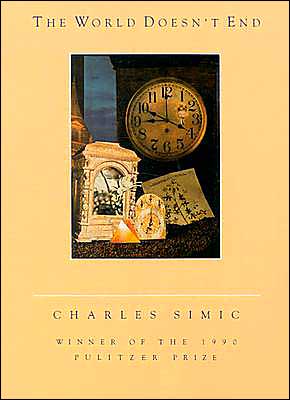
Like most people I imagine, my first experience with a Cornell box was not in a museum but through poetry. One of my favorite books of poems is Charles Simics The World Doesnt End, which is a small book of prose poems by turns fantastical and surreal but deeply grounded in the everyday, a kind of poetry that hails from a place where, as Simic himself writes in his poem Folk Songs, the dog barking at the moon is the only poet. The book was a revelation for me. It proved everything was possible in poetry (I hadnt yet read the surrealists nor had much exposure to the writers and artists Simic draws from). But not only was anything possible, it could be written in a language that made sense; theres nothing that screams Poetry with a capital P here, theres no puzzle to these poems beyond the poems themselves, which are absolutely drenched in mystery and joy, even when at their most angry or sad. So I was immediately enamored, and like a good autistic kid, wanted to find and devour everything that had to do with this book.
So I started with the cover and, lo and behold, on the cover was a collage by Joseph Cornell. So I began looking for other collages and work by Cornell, which led me to my colleges library. And its there I fell in love with Cornells boxes, reading his diaries and flipping through old and faded books featuring horrible reproductions. Subsequently, I discovered Simic himself had written an entire book on Cornell (more on that below), and realized just how unique and eccentric and profoundly magical Cornells work is. His boxes are in effect visual poems, cooked with all the same mysterious juices as poetry. But not only is his work replete with poetry, his life is a kind of poem itself and worth the same attention as his work since his art is inextricable from his biography. And by biography I dont just mean the facts of his life, but the map of his imagination as well.
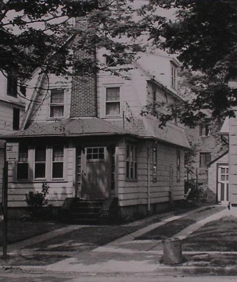
Cornell was not a typical artist. Although he participated in the art world of his time, allowing his boxes to appear in exhibitions all over the world and cultivating friendships with a myriad of artists (including Marcel Duchamp and Max Ernst), he was not a prominent, social figure, and stayed away from the trappings and pretensions of the community his work was forced by default to be part of. Instead Cornell was a recluse, only once leaving New York his entire life (to attend college in Andover, Massachusetts from 1917 to 1919, which he failed out of), and living for most of his life in a small frame house on Utopia Parkway in Flushing, New York. For the majority of his adult life, after his father died, he cared for and looked after his mother and crippled brother, Robert, who suffered from cerebral palsy. Cornell was born on December 24, 1903 and died on December 29, 1972. He lived a quiet life, making his art in his basement studio, which was more of a junk shop, the walls lined magazines and books, and trays and boxes filled with everything Cornell included inside his boxes and more he didnt. Unlike many of the artists of his time, Cornell was a highly religious man. Early in his adult life he converted to Christian Science and many of his later works, especially his white dovecotes, which are void of the more colorful and eccentric objects his earlier work is replete withthere are none of his famous parrots, start charts, or bellsjust whitewashed space, as if he was working towards something of infinite calm and purity.
Joseph Cornell Rose Hobart (1936)
In addition to Cornells collages, boxes, and various assemblages, he also dabbled in film. He spliced together scenes from films in a sort of collage to create new narratives. Among his films, Rose Hobart (1936) is the most well-known, although still languishing in almost total obscurity. The film was made entirely from existing film stock of other movies, and whenever Cornell showed it to audiences hed project it through a deep blue glass filter, giving the film a dreamlike effect. Interestingly, when Cornell premiered the film in December 1936 at the Museum of Modern Art in New York, Salvador Dali was attending the MOMA opening. During the screening, Dali became enraged and flipped over the film projector, claiming Cornell had stolen the idea [for the film] from his subconscious. Traumatized, Cornell rarely showed it again (Wikipedia). The films though mysterious in their own way, lack the same inherent power of his best boxes.
Joseph Cornell The Midnight Party (1938)
Joseph Cornell The Aviary (1954)
Joseph Cornell Angel (1957)
Although photographs of Cornells work are widely available in books and on the internet (many of which Ive included in a few galleries below), I urge anyone interested to see Cornells boxes in the flesh, up close, any way you can. Periodically, museums curate large shows featuring his work, but it is scattered throughout the world. There are a number of museums in Chicago, New York, London, and Washington D.C., as well as throughout California, that display Cornells work. So if youre ever awarded the chance, even if youre on the fence about what you think of Cornell, go see them. Youll be persuaded, trust me. And if youve already been persuaded, youll most likely be transfixed, transformed, and taught something in some inexplicable and mysterious way.
2. Le Galerie de L’Enfance Regagné
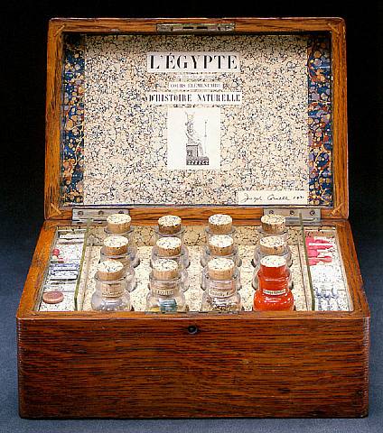
1. LÉgypte de Mlle Cléo de Mérode Cours Élémentaire DHistoire Naturelle, C. 1940.
Throughout his life, Cornell was fascinated by women with mystique, explains collector and Cornell enthusiast, Robert Lehrman, and this box is an homage, not only to one, but two of those women, Entitled Cléo de Mérode, it refers to the 19th century Belle Époque dancer and courtesan, as well as the even more famous Cleopatra of the Nile. And encased in this seemingly simple box, perhaps with the same interest that the Egyptian ancestors might have had of keeping treasure hidden, we see a treasure trove of Cornells imagination, contained in these glass bottles, in which Cornell gives us allusions to the life of Cleopatra. In one bottle he shows us her beautiful blue jewels. In another, he gives us a photograph of Cléo de Mérode…and she is placed in the yellow sands of the desert. In another bottle, Cornell gives us the actual image of the sphinx, which is suggestively created and cut out to look like the photograph of Cléo de Mérode. And in another bottle, we have the representations of the wheat fields, which would have been the source of the Niles great success agriculturally, which then supported the rise of the civilization and permitted the ancient wonders of the world to be built there. So that in this amazing casket Cornell has encapsulated an entire history with as its main touchstone, the reverence for, and fascination of the woman of history.
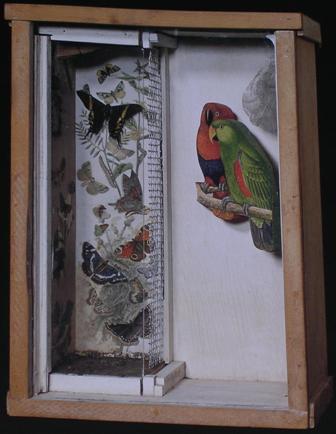
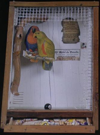
2. Untitled (Parrot and Butterfly Habitat), C. 1948
Part of [Cornells] genius lay in being able to project himself into the experience of something else completely different, explains art historian Dawn Ades about Cornells fascination with birds. Like, if he watches a sparrow pecking among the gravel outside his window, he becomes that sparrow pecking at the gravel outside the window. And in spite of the fact that [he uses] readymade birds, you also feel theyre set into motion in some way, which to me is a little bit similar. Its as though Cornell is identifying with the habitat of these birds. The birds are perching on twigs, twittering, balancing, perhaps diving for food This is only one aspect of it because you have so many other complicating elements there, like the columns of figures and the numbers. Are these related to games? Perhaps even shooting targets. And so suddenly, as so often happens when youre looking at a Cornell box, having followed one direction, you suddenly come back and find that theres something actually a little bit more sinister underlying it.
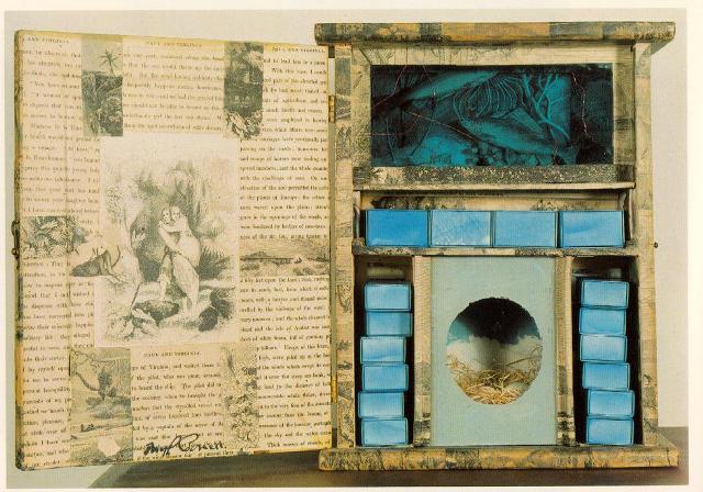
3. Untitled (Paul and Virginia), C. 1946-48
The box Paul and Virginia is probably one of Cornells most complex works, says Lynda Roscoe Hartigan, curator of painting and sculpture for the National Museum of American Art at the Smithsonian Institution in Washington DC. Its almost like three-dimensional literature The story of Paul and Virginia is based on that of a French author from the late 18th century, that became wildly popular during the Victorian era all around the world. So that Cornell, in his various perambulations through libraries, came across English versions of the story and his grandfather actually owned one of the many romantic lithographs that interpreted events in the story line and Cornell remembered that as well. The story of Paul and Virginia has to do with two star-crossed lovers. They were born on an island in the Indian Ocean and were destined to marry, until Virginia was taken off to Europe. She tried desperately to return, and as she did, her ship sank in sight of her lover, Paul. He tried to get to her desperately, and she died in his arms. So in many respects this is actually something of a casket for both Paul and Virginia. Because the box is covered with illustrations from one of the books, Paul and Virginia, and you see different snippets from their happy life on the island, as well as images that suggest the hard things that happened to them. That mysterious dark blue chamber at the top of box actually has, when youre able to peer into it, images of fish, which could suggest the watery grave that Virginia actually went to. Dead center at the bottom theres a little robins nest with robins egg, blue eggs-and while they were children, Paul and Virginia used to gather nests as tokens of affection for one another. They also gathered widows flowers, which have the color blueand the box is dominated by the color blue. And so you begin to have this whole sense that hes trying to capture both the early and the later events in Paul and Virginias life, as sort of a cabinet in honor of the two young lovers.
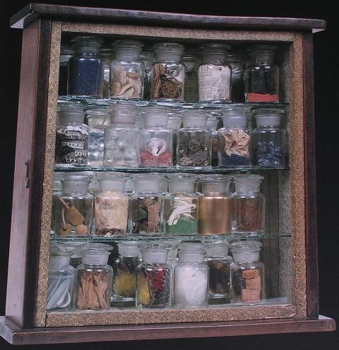
4. Untitled (Pharmacy), C. 1942
From the 1930s to the 1950s, Cornell converted numerous old wood boxesonce used to store and carry writing accessories, jewelry, medicines, and toiletriesinto works that he often described as Museums and Pharmacies, writes Lynda Roscoe Hartigan. Usually they feature vials or bottles filled with found objects, especially shells, sands and colored liquids, feathers, snippets of text and illustrations, beads, marbles, and mineral and wood samples. The selection of materials is inherently poetic, yet the bottled, orderly compendia suggest that a scientist, magician, or collector has been at work. Chests, cabinets, and museums fulfill mans need to preserve, classify, and display specimens, documents, mementos, and treasures. The tradition of the cabinet of curiosities and the Wunderkammer (room of wonders) have played illustrious roles in the evolution of museums, and Cornell tapped into these traditions in creating his own Museums. He also used old chests and cabinets, some with doors, shelves, and handles, to create miniature reliquaries dedicated to historical figures and fictional characters.
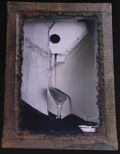
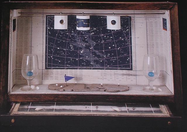
5. Untitled (Blue Sand Fountain), C. 1954-56
As the blue sand cascades down from the reservoir at the top of the box, writes Robert Lehrman, little flecks of white paint skitter across the blue like comets or shooting stars in the night sky. These heavenly bodies have dislodged from the sides of the box through an aging process that Cornell intentionally created by applying repeated layers of paint, each baked in his kitchen oven, to vintage the boxes. His Sand Fountains are miniature theaters of time. As the sand falls here, it overflows the cordial glass and, with the undulating movement of a tide, eventually covers the small starfish at the bottom of the boxsuggesting both a creature in the deep blue sea and a star in the night sky.
3. Five Recommended Books
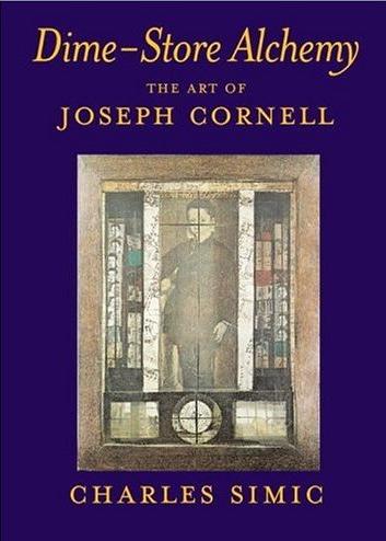
1. Dime-Store Alchemy: The Art of Joseph Cornell by Charles Simic
In the preface to his beautifully imagined collection, as Mark Strand writes, of crystalline paragraphs, of irreplaceable miniatures in homage to Joseph Cornell, Simic observes Cornells genius and originality disarm critics and make them affectionate and inspired. And it is true not only of the best criticism about Cornell but the best art directly inspired by his work. And Simics own book Dime-Store Alchemy is among the best. As Simic also states in his preface, in his own work he is not only trying to approximate Cornells method in language but try to understand him as well. And I believe Simic succeeds, as unquestionably does Cornell, in articulating what Cornell in an undated diary entry wisely calls that desperation of trying to give shape to obsessions. So here are a few of Simics shaped obsessions from Dime-Store Alchemy:
Poetics of Miniature
—-Perhaps the ideal way to observe the boxes is to place them on the floor and lie down beside them. —-It is not surprising that child faces stare out of the boxes and that they have the dreamy look of children at play. Theirs is a happy solitude of time without clocks when children are masters of their world. Cornells boxes are reliquaries of days when imagination reigned. They are inviting us, of course, to start our childhood reveries all over again.
Cornells White Nights
A room that is like a reverie. Baudelaire
—-Insomnia is an all-night travel agency with posters advertising faraway places. There the sea is always blue and so is the sky. A little white hotel with green shutters waits for you, each one of its rooms a thing of twilight, bluish and roseate. —-Like a traveler weary of his journeying, you undress with the window open. The setting sun wears a red turban. The sea is dark blue. In the lush garden sparrows are darting. When the night finally falls, veiled Scheherazade will bring mint tea to your bed. —-In the meantime, silence and your shadow on the bare wall.
I Went to the Gypsy
—-What Cornell sought in his walks in the city, the fortune-tellers already practices in their parlors. Faces bent over cards, coffee dregs, crystals, divination by contemplation of surfaces which stimulate inner visions and poetic faculties. —-De Chirico says: One can deduce and conclude that every object has two aspects: one current, which we see nearly always and which is seen by men in general; and the other, which is spectral and metaphysical and seen only by rare individuals in moments of clairvoyance —-Hes right. Here comes the bruja, dressed in black, her lips and fingernails painted blood-red. She saw into the murderers lovesick heart, and now its your turn, mister.
Postcards from a Far-Off Place
1. Weve recovered our old amazement.
2. In L. the undertaker ran a toy shop next to his grim establishment.
3. In the desert of P. we saw many large black birds which we were told were ghosts of their ancestors.
4. In D. we were served potions of lime sherbet by a naked little girl.
5. In Z. we met the deaf-and-dumb painter of doll faces.
Sleepwalkers Travel Guide
—-The Grand Hotel of the Universe with is tower clock stopped. —-The shrouded chairs and sofas in the Hotel Bad Dreams. —-The cry of love in the Hotel of the Eternal Moment. —-Hotel of the Bloody Revolution on the Avenue of Fates and Furies. Two black shoes with worn heels left under its entrance awning. —-Our dead grandmother staring at an empty plate in the Hotel of the Great Secret. —-On the same street, Hotel of the Erased Name. St. Sebastian pierced by arrows at the open door. St. Lucie holding her eyes on a plate in one of the high, sun-bloodied windows. —-And on the corner, the angel of death in a yellow taxi rounding up guests for the Hotel Night Sky.
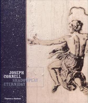
2. Joseph Cornell: Shadowplay Eterniday by Lynda Roscoe Hartigan, Robert Lehrman, Walter Hopps, and Richard Vine
Although there are almost as many books of criticism, reproductions, and personal essays as there are Cornell boxes, none but Shadowplay Eterniday delivers more in giving its readers as close an experience with the work outside of actually touching the boxes themselves. Not only is the book packed with essays and ripe with glossy, full page (and occasionally double page) spreads of Cornells collages, boxes, and an assortment of early work as well as photographs of himself, his family, his home, and various ephemera from his collection, housed inside the back-cover of is an beautifully designed interactive DVD-ROM, which, according to The New York Times, transforms the user into Alice in Wonderland It gives the opportunity to explore Cornells universe through more than 250 of his boxes and collages. And it is no exaggeration. Using the DVD, you are able to manipulate practically all of Cornells work with a touch of your mouse. For example, here is what you can do with a box: rotate and revolve, zoom in to examine the boxs every last paint chip, crack or peel, peek into its drawers, listen to the tinkling of its blue marbles within their glass vials, trace the courses of the inlaid maps, watch its sands form majestic pyramids or mimic comets shooting through the darkest space. You can listen to commentaries on particular boxes by critics and collectors, and enthusiasts. And if that werent enough, also included are many of Cornells strange and Frankenstein-like films.
Among the many essays included, which range from an exploration of Christian Sciences influence of Cornells to an investigation of the many dualities seemingly present in Cornells work (accumulation/classification, physicality/abstraction, literalism/illusionism, compression/magnification, and repetition/variation), there is a long section by collector Robert Lehrman about his experience living with and interacting on the most personal level imaginable outside of the maker himself, a number of Cornells boxes. Besides the lavish photographs, and extraordinarily mind-bending DVD-ROM (which are achievements enough) it is this section featuring Lehrmans insights that differentiates this book from all others on the same subject (though it seems in the coming months there are a number of other books on Cornell coming into publication that look just as delightfully magical, such as Lynda Roscoe Hartigans own expanded study on Cornell, as well as a sort of actual wonder cabinet by Joan Sommers and Ascha Drake called The Joseph Cornell Box: Found Objects, Magical World, which looks as though it will feature reproductions of an assortment of treasures present in the boxes themselves, such as pages from old books, dime-store trinkets, glass bottles, shells, cut-outs of tropical birds and butterflies, wooden balls, dice, pinwheels, and no doubt more).
Cornells boxes are meant to be handled, Lehrman rightfully contends, and there are secrets that cannot be uncovered and experienced if you only view the boxes in a book or in a museum. This is one of the many remarkable qualities of Cornells work. Unlike so much modern art, Cornells is inherently interactive. He intended his boxes to be experienced sensually; they were not made for museums, and are in fact completely antagonistic to the museum experience, which often distances the art from the viewer instead of drawing them in closer so as to draw them further inside themselves. Cornells boxes are some of the most intimate, fragile, and quiet creations I know of. They require solitude and time, and if the elements are right, like a time machine youll be momentarily transported back into the feelings of childhood whether real or imagined, or whether its Cornells, your own, or some mix in-between it doesnt matter; its safe there.
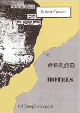
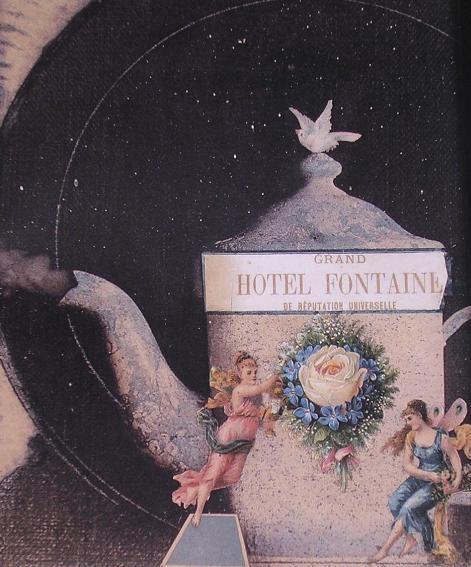
3. The Grand Hotels (of Joseph Cornell) by Robert Coover
Like Simics collection of crystalline paragraphs, Robert Coover has created his own book of Calvino-esque (a la Invisible Cities) imaginings in homage to Cornell. But instead of writing a book as varied and multiform as Cornells assemblages as Simic did, Coover turns his focus exclusively on Cornells imaginary hotels. But instead of writing around Cornells hotels, he imagines his own: The Grand Hotel Nymphlight, which is a hotel within a hotel that purports to be the only establishment specifically devoted to the child within, literally; The Grand Hotel Galactic Center, which is constructed of numerous interlocking spheres that open to the night sky in all its cosmic grandeur, but which are also susceptible to black holes opening within their crevices, through which people intent on suicide are sucked into; and The Grand Hotel Penny Arcade, at whose center is a solitary sleeping princess, naked and doll-like, who does not need a prince, but is on showcase for anyone who wishes to dream she does These are just a few of the many hotels Coover imagines. As you read, you gradually feel transported to this magic city of luxury hotels, as if youre Ali Baba entering the cave in astonishment upon uttering open sesame! Like Coovers hotels, one of the wonders of Cornells boxes is that they are in no way didactic. In fact, as Simic writes, they are invitations to dream; and of his and Coovers hotels, youre invited to imagine your own. So heres my favorite of Coovers inventions, The Grand Hotel Forgotten Game to spirit you away:
The Grand Hotel Forgotten Game
—-Unlike many of the other grand hotels, the Grand Hotel Forgotten Game is as easy to find as closing ones eyes and opening them again. The front desk, on the other hand, is deeply concealed within a labyrinth of moveable panels of wood and glass, and is shifted about from hour to hour, making checking into the hotel the first game one is obliged to play here, though by no means the most difficult. It is childs play compared, for example, to finding ones room afterwards. At the entrance on the revolving doors (which are tricky; not everyone gets inside on the first try), there is posted a quotation, attributed to a 19th century saint, that reads: Now, here, you see, it takes all the running you can do, to keep in the same place. Though newcomers might be baffled by such an announcement, Forgotten Game regulars understand it to be a clue, by reverse logic, to finding the front desk: Locate yourself in a safe place and let the front desk come to you. —-The rooms, however, can be accessed only by Ferris wheels and carousels (there are no elevators, stairs or ordinary corridors, though one learns to recognize certain playgrounds and amusement parlors as secret routes of passage), such that odds of being dropped off at ones room are about the same as winning at roulette. Nor is reaching ones doorif one ever doesthe end of the game, for inserting the key can cause the floor in front of the door to drop away (the guessing and singing of the song of the day while inserting the key can prevent this) and send the guest flying down a ramp of wooden rollers past holes in the hole at which other guests are shooting with paint guns. The chute continues all the way to the bottom of the hotel, where it releases the splattered guest into the alleyway at the back, and the process begins all over again. —-The hotel staff are all delightfully charming and kind, given to generous laughter, warm embraces, and amusing aphorisms, and playing hide and seek with the chambermaids and bellhops is not only encouraged it is the only way to get breakfast or have your bed made but it is useless to ask them for directions or advice when lost in the hotel. Not only are they instructed to provide false clues and misinformation, many of them are deceivingly lifelike automata, programmed to provide random replies no matter what the questions. But clues are to be found everywhere; one need only look and sensibly puzzle out what one sees. Even the patterns of the colored sand in the sandboxes may provide directions, or the worn areas of carpets, the casual spray of jacks or marbles, the squawk of a parrot, candy wrappers behind a chair, a stack of alphabet blocks. At some point, one will probably lose track of ones luggage, but, once the room is found, there will be luggage in it, probably not ones own, but no matter. People dressing up in one anothers clothes is art of the hotel policy to get everyone playing together. Mail and messages are not delivered but are hidden about the hotel like Easter eggs, finders keepers, and indeed Easter bunnies (live and otherwise) are a cheerful decorative motif throughout. The restaurant menus are playing cards and one must find a guest with a matching card before being servedas a pair of course. The menus themselves list no dishes only conundrums, such as What is the color of surprise? or Where exactly is the universe? or If time runs, where does it run to? or What does an egg mean? and the guests are served according to their answers, usually to their complete satisfaction. There are costume parties every night, if one can find them, with dancing contests and sack races and sing-alongs. The playful atmosphere has provoked new games invented by the guests like goosey gander, nipple tag, and musical beds, but these innovations are not encouraged by the management, and such guests often find themselves suddenly shooting the chutes once more and landing in the alley. —-The colors in the Grand Hotel Forgotten Game are mostly primary, the ambient music that of a rollicking hurdy-gurdy, and the dispersed aromas range from those of ice cream parlors and fireworks to hot asphalt, pencil sharpeners, and the seaside, depending on where one finds oneself in the hotel, and when. Indeed, there is, though not easy to find, a seaside beach somewhere in the hotel where the hurdy-gurdy melodies fade away behind the sounds of sand and pebbles sucking sea water, waves slapping against wooden piers, and the cries of wheeling gulls. There are shellfish expeditions here, daily beach parties featuring sand castle building and blindmans buff on the boardwalk, and fishing competitions from the piers, where one catches not fish but fortunes and sometimes toy cars or plastic earrings. Transoceanic excursions can be arranged for guests on extended stays, with overnights in the Tropical Island Beach Hut, which can also be reached by taking the Ferris wheel to the sixth floor, if one can find it (it is not between the fifth and seventh). —-At the top of the hotel in the middle of a set of Chinese boxes is the Game Room (this is not the casino, which is called The Schoolyard), where management and staff meet with the design team to plot out each days activities and the structural adjustments required. It is here that all the jokes and riddles are dreamed up and the fun invented. It is widely assumed (the hotels publicity department encourages this public assumption) that these Game Room meetings are the happiest games of all at the Grand Hotel Forgotten Game, yet witnesses who have stumbled into the Game Room, looking in vain for their own rooms, have reported dim lights, a heavy air faintly redolent of old shoes and books, and a prevailing mood of inwardness and preoccupation, melancholy, wistfulness, in which, say, the blowing of a soap bubble would be a cause for tears.
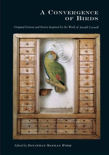
4. A Convergence of Birds edited by Jonathan Safran Foer
Before his novels Everything is Illuminated and Extremely Loud & Incredibly Close, Jonathan Safran Foer, while at Princeton, edited and put together a beautifully illustrated book in homage to Cornell featuring pieces by a legion of renowned writers, poets, and Cornell enthusiasts including Joyce Carol Oates, John Ashbery, Robert Pinsky, Rick Moody, Mary Caponegro, Lydia Davis, Howard Norman, Robert Coover, and John Yau. Unlike almost any other artist, Cornell doesnt inspire academic exegesis but instead elicits the most personal, intimate responses from even the most hardened critics. Those who dismiss Cornell as another participant albeit pioneer in the cold-hearted realm of pop-art are gravely mistaken and probably have made their assessment based on quick glances at Cornells work, seeing that he makes boxes using everyday objects. How many times have you heard a friend say of a painting or something, Even I could do that! The funny thing is, no one can ever hope replicate a Cornell box. Its impossible because Cornell has created a particularly personal art that fits only as his skin fit around his frame. Not many artists can claim to be wholly inseparable from their work and their work wholly inseparable from them. Thus any attempt to build a Cornell box inevitably ends in failure. The best way to approach Cornell is, as Charles Simic writes, through approximation, and this is what these many writers in A Convergence of Birds attempt.
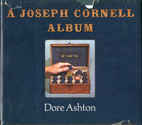
5. A Joseph Cornell Album edited by Dore Ashton
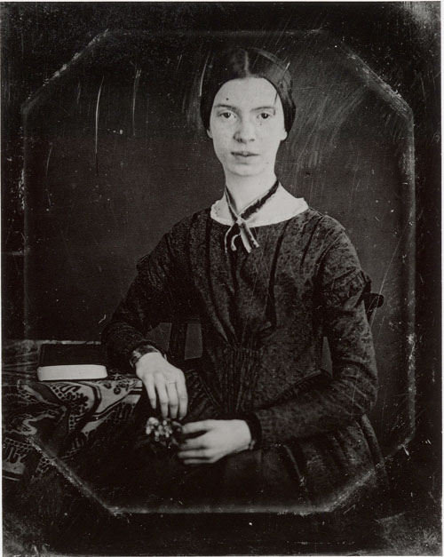
Of the writers Cornell seems to have had the most influence on the majority are, not surprisingly, poets. Why is this and why is it not surprising? Cornell himself was a ferocious reader, particularly of poetry. Being a Francophile, Cornell was obviously drawn to the French poets and writers, particularly, Gerard de Nerval, Paul Valery, Stéphane Mallarmé, and the requisite French surrealists such as André Breton and Le Comte de Lautréamont. But Cornell was also well-read in English poetry. His favorite was, again not surprisingly, Emily Dickinson, to whom he dedicated a number of boxes, and with whose poems his work share innumerable resonances. A few years ago, I gave a friend a framed photograph of my favorite of Cornells boxes, Untitled (Aviary with Parrot and Drawers), C. 1949 (featured on the cover of A Convergence of Birds) and hidden on the back of the photograph, beneath the frame (if shes reading this and hadnt already discovered it, she knows now), an Emily Dickinson poem, which I felt was particularly apropos of this box, given that its series of drawers are all empty, and at the head of the parrot is a small, metal spiral, seemingly alluding to infinity, and to my mind, the infinitesimal and oftentimes inexplicable possibilities of the imagination. Again not surprisingly I dont remember what poem I wrote on the back of the photograph, but if my friend happens to be reading this, maybe she can post it and solve this small mystery.
What is delightful about Dore Ashtons album on Cornell is, like Foers anthology, she includes many pieces written by poets and as well as critics including John Ashbery again, Stanley Kunitz, and Octavio Paz. But even more wonderful she includes excerpts from Cornells own recommended reading list, featuring work by John Donne, Dickinson, Nerval, Mallarmé, Eugéne Delacroix, Henry James, and Thomas de Quincey, so that you can not only read work inspired by Cornell but work that inspired him. But to answer my own question I asked above about why poets are so drawn to Cornell: Cornell shares the same sensibility for the confluence of the everyday and the extraordinary as many poets do. Like the poets he revered, Cornell believed that even the most common objectsa thimble, a dolls head, a snowglobe inside which is a miniature city, sparrow, a childs Halloween mask, a seashell, a photograph of a woman frowningwere like lead and only need the right display of alchemy to turn them into gold. Because the world is so filled with the physical, Cornell believed that even the cheapest dime-store trinket could open up a wormhole to where? To Honah Lee? Back to childhood and its dreameries?
4. The Postcard Palace (for Callum)
Since Cornell used various ephemera (including postcards) from antique shops, bookstores, basement sales, libraries, and any number of other sources to construct his boxes and collages, and that he gave away many of his boxes as gifts to good friends and young children, I thought it would be appropriate to do a sort of give-away with a similar spirit in honor of Cornell. So here it is: I happen to have a bundle of beautiful postcards featuring photos of a selection of Cornells boxes lying around that I havent used, so Im offering them to you. The first five people who drop me an e-mail with their address, Ill send a postcard their way. My e-mail is: msuss@clarku.edu. And thanks to Callum and his Postcard Palace for the idea. Bonne chance!
5. Le Galerie des Jeux Cosmiques
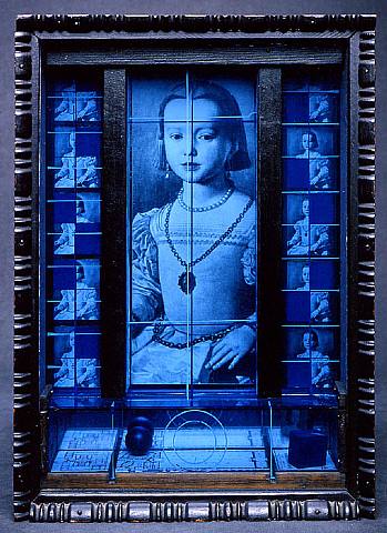
1. Untitled (Medici Princess), C. 1952-54
This haunting image of Bronzinos Portrait of Bia di Cosimo de Medici in Cornells hands has become dream and homage and elegy, writes Lehrman. Cornell shrouded his princess in mystery by placing her in the center of a complex cabinet and behind three plates of glass, one tinted bluethe color of the night from which she is constantly emerging somehow it evokes memory. The princess is flanked by quartered images of herself in which one or two sections are always obscured by a darker blue, as if in a flickering and incomplete image on film. She seems simultaneously in motion and forever still. The notion exists that part of her, lost to time and irretrievable, is echoed by her hidden image, which is reflected from the back of the blue cube onto a mirror in the lower portion of the box. Portrayed at a young and tender age, the princess nevertheless displays the formal trappings and gravity of royalty. The fact that she died very young would not have been lost on Cornell, who characteristically in his desire to protect and idealize children enshrined her spirit in this hauntingly beautiful work.
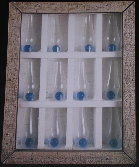
2. An Image for Two Emilies, C. 1954
The two Emilies referred to in the title, refers to Emily Dickinsons friend, whom Cornell learned she had a very close and meaningful relationship with, explains Lehrman. And one could well imagine, in a white-washed winter landscape in Amherst, Massachusetts, Emily Dickinsons excitement upon the pending arrival of her visiting friend, perhaps drawn by horse-drawn sleigh. And that sound of the approaching sleigh-bells is almost mimicked by the blue marbles [tinkling against the boxs glass front.]
3. Untitled (Pink Palace), C. 1946-48
Once Cornell discovered the international revival of the Romantic Ballet in the late 1930s, writes Lynda Roscoe Hartigan, he spent the next thirty years exploring his fascination with the queens of the dance. He described his dance-related boxes as souvenir cases or bouquets, and often included the phrase Homage to the Romantic Ballet or cited specific ballets in their titles. Many of the boxes refer to ballerinas such as the Romantic eras prima ballerina Marie Taglioni or her modern counterpartsTamara Toumanova and Renée Jeanmarie among themwhose interpretive talents and grace contributed to the Romantic Ballets revival. Several works incorporate miniature reproductions of ballerinas portraits from Cornells extensive collection of dance ephemera. Yet his use of delicate materialsbits of ribbon and tulle, costume beading, dried flowers and butterfly wingsis often enough to suggest that his dance-related boxes are conceptual portraits of the ballerina as a timeless creative spirit and the embodiment of all too fleeting beauty. Reflecting his sensitivity to set design and narrative, other examples present metaphorical versions of famous ballets such as Swan Lake or Sleeping Beauty, the source of inspiration for his series of Pink Palaces…
4. The Caliph of Bagdad, C. 1954
Although [Cornell] rarely committed explanations of his work to paper, Hartigan writes, the impact of seeing a pet stores display of tropical birds during the late 1930s moved him to describe in some detail the origins and approach for his Aviaries: original transcription of the bird store, windows, simplicity of magic, pet shop AVIARY Project: large or small cage with mobile effects: swinging perches, swinging rings, pieces of bird-feed, etc. etc.; consider exotic colourings (notebook/scrapbook); try for effect of prolonged motion from mobiles; use of scraps or straight pieces of mirror; touches of jetsam; used woods; springs; inner chamber of arranged mirrors for accentuated effect of depth; for general-notes: paste patches against white background, then repaint thick whitefrom here develop Directions: clean and abstract; lived in mussy aspect.
5. Untitled, C. 1956-58
Most often Cornells three-dimensional poems contain those things essential to movement in space, writes novelist Rikki Ducornet in an entitled Books of Nature: The Poetry of César Vallejo and the Boxes of Joseph Cornell (included in her absolutely phantasmagorical book of essays The Monstrous and the Marvelous, which explored everything from Kafka and Borges to Lewis Carroll and David Lynch to Gaston Bachelard and the Marquis de Sade, and everyone and everything under the sun), compasses, watches, earth, sun and moon maps, star chartsor they evoke games which rely upon the mastery of projectiles and itineraries such as slot machines, penny arcades and shooting galleries. His aviarieswith their mirrors, peepholes and clock springsfit into this category (because they promise to tell us something about migration) as do his Observatories and Sand Fountains. Some boxes reveal the workings of wind; others divulge the time of the suns rising and setting and the exact length of days and nights; another explains the phases of the moon; yet another describes the elements which make up the cosmos. (And Cornells Star Hotels are just that: they offer rooms in space.) A glimpse of one interior gives a peep shows ideal view of a sky bristling with zodiacs. All Cornells boxes are time machines; they take us into memorys deepest recesses, to those sublime moments of infancy when the world still spelled enchantment.
p.s. Hey. ** David, Hi. Well, thanks for the throwback bodily tour, man. ** David Ehrenstein, Happy birthday! ** Misanthrope, Turns out hell’s not so bad. Who’d have thunk? Ah, I know what press you mean then. That would be cool. Fingers crossed. ** _Black_Acrylic, Hi, Ben. How was the class? Do you think a flash-based novella is for you? I hope it was distracting if nothing else. Love, me. ** Dominik, Hi!!! I’ve never read the Bible either. Even with the pdf of the book yesterday, I kind of barely skimmed the text. Oh, I feel sad for your younger self. Sounds traumatic even. Your mom should’ve sued or something. My guess is our previous loves are a toss up. Well, depending on how quickly my love spat out the chocolate’s corpse. Ha ha, good one: your mono-brow love. Half-blind potter love mistaking Shawn Mendes’s head for a lump of clay and pounding and smushing it into a flower pot while wondering ‘what’s that strange screaming sound?’, G. ** Bill, I’ve seen bits and pieces of Crumb’s take. ‘3 Women’ is an awfully high comparison point. And a ‘more operatic’ ‘3 Women’ is a flummoxing notion. Might really need to solve that mystery. ** l@rst, Yay! A sale! Not having read The Bible, I suspect the degree to which you’ll need to skim it will make Finnegans Wake seem like a page turner, but who knows. Big up, bud. ** Maria, Isabella, Camila, Malaria, Gabriela, Wow. I almost never get sick, and, when I do, I mostly just have to blow my nose a lot. Maybe because I’ve never read the Bible? I wonder. So that flu sounds epic. My goodness. ** Steve Erickson, Yeah, I had two very bad LSD freak outs as a teen and, after that, even a tiny puff of pot or hash would trigger off the freak out, so I had to quit that stuff for good. ** TJ, Totally makes sense, right? I hope your Friday = Funday. ** Brian, Hey, Brian. I especially like the unboxing of those elaborate ltd. ed. vinyl or CD or DVD packages for ultra fans, but I guess that’s not difficult to justify. I wonder if the moment I’m remembering in ‘Salo’ is the moment you’re referring to. So, ‘Drive My Car’ just got removed from my free site, and it only seems to be watchable on HBO Max, and I’m not joining that just to watch ‘DMC’, so either my fellow book club people will have caught it in time and I’ll listen to their reviews, or we’ll be stuck. You guys have another three-day weekend there? The US has so may three-day weekends, it’s nuts. I hope you fully de-exhaust. I didn’t know that about Anger re: ‘The Story of O’. It’s not a good novel, but then not good novels are often the best film fodder. I might have mentioned before that Anger wanted to make a film of my first novel ‘Closer’. He wrote this long letter to me explaining what he wanted to do and asking for my permission, and of course I wrote back with the equivalent of ‘Yes! Please!!!’ But he never made it, obviously. I have a feeling the did that a lot. Freaky Friday! ** Okay. I recently found this quite old and fantastic post made by a long lost distinguished local named Matthew Suss about the unimpeachable Joseph Cornell, and it’s pretty terrific right? See you tomorrow.


 Now available in North America